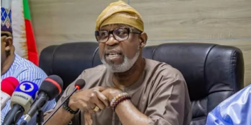
The Surveyor General of the Federation, Surv. Abdulganiyu Adebomehin has disclosed that President Bola Ahmed Tinubu has approved earth mapping of the entire country.
He said surveyors have the capacity to help security agencies overcome security challenges with proper mapping.
He disclosed this at the 3rd Biennial General Meeting and Conference 2025 of the Nigerian Institution of Surveyors, FCT Branch, with the theme “Artificial Intelligence (AI) and Geospatial Technology (GT): For Mapping of Earth Resources and National Security” in Abuja.
He lamented that no money has been released for the year 2025 due to confusion in the budgeting system.
He said the President, being an accountant, is likely not to implement the 2025 budget because, before now, the 2023 and 2024 budget cycles have been running concurrently.
He said, “What we are saying now is that we have a lot of things on the table. I was with the President, and he said, ‘What is the problem of surveyors?’ I said, ‘Mapping.’ He asked, ‘When was the last time we mapped?’ I said, ‘1960, 1970.’ So, he approved mapping the whole country.
In his keynote address, Surv. Lawrence Akinola said that though surveyors have the capacity to help security agencies overcome security threats, there was no political will to address the challenge.
He emphasised the importance of human resource development and training to address future challenges.
He called on government agencies and stakeholders to ensure adequate storage and a warehouse for Artificial Intelligence.
He warned that Nigeria’s AI bill proposal, currently before the National Assembly, would make it mandatory for developers and users to register and obtain licenses.
He further charged the body to “Think out of the box” to secure long-term funding.
In his welcome remarks, the chairman of the organising committee, Surv. Emmanuel Omuya said Artificial Intelligence and Geospatial Technology were redefining how societies perceive space, manage resources, and safeguard their territories across the globe.
He said Nigeria must not be left behind in the revolutionary effects of AI.
He said, Surveyors stand at the confluence of technology and national development.
This, he said, is because the data they collect, the maps they draw and the decisions they take have implications that extend far beyond the cadastral boundaries; “they touch the realms of security, economy, and governance. It is in this spirit that we must embrace emerging technologies, not as threats to tradition, but as tools to amplify precision, speed, and insight.”
He described Abuja as a living template of planning, a laboratory of spatial intelligence, and the most fitting ground to demonstrate how Geospatial Technology and artificial intelligence can drive more intelligent infrastructure, safer communities, and more responsive governance.
He therefore stated that to model Nigeria, Abuja must first be modelled.
“Let us remember that the future of surveying lies not in resisting change but in mastering it. AI will not replace the surveyor: it will only empower the surveyor who adapts.”


