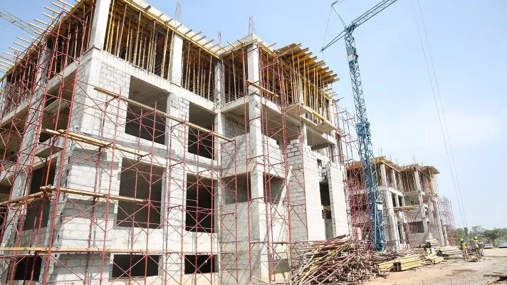
The Lagos State government has issued a stern directive mandating property owners to acquire a Certificate of Completion and Fitness for Habitation for their buildings.
The Special Adviser to the Lagos State Governor on e-GIS and Urban Development, Mr. Olajide Babatunde, who gave the directive during a ministerial press briefing held on Monday to mark the second anniversary of Governor Babajide Sanwo-Olu’s second term in office, said it is part of intensified efforts to ensure structural safety and prevent building collapses.
Babatunde stated that the measure is crucial to addressing the recurring issue of building collapses in Lagos and is part of the government’s commitment to creating a safe and orderly built environment.
He emphasised that no building would be allowed to be occupied without meeting the required safety and structural standards.
The special adviser said, “215 certificates of completion and fitness were issued to building owners and developers after stage-by-stage inspections of their building process by the Lagos State Building Control Agency( LASBCA), through the Building Certification Department (BCD).”
Babatunde pointed to the ongoing implementation of the Enterprise Geographic Information Service (e-GIS), spearheaded by the Lagos Geographic Information Service (LAGIS), highlighting the government’s progress in modernising land administration and urban development.
He said the initiative is revolutionising the state’s collection, processing, and use of land records, planning data, and geospatial information.
According to Babatunde, the e-GIS Office is working to automate and integrate the digitisation efforts of key government agencies, including the Lands Bureau, Physical Planning Department, Land Use Charge Office, and the Office of the State Surveyor-General.
“Since its inception in 2016 and the formal establishment of the e-GIS Office in 2021, the project has delivered a comprehensive, computerised spatial data infrastructure to support smarter governance”, he said.
He further revealed that the initiative involves a state-wide mapping and survey project in collaboration with the Surveyor-General’s Office, using advanced technologies such as UAV drones, RTK systems, and cadastral software for precise land mapping and data collection.
Babatunde stated that the e-GIS Office is driving capacity building in Geographic Information Systems (GIS) across the civil service and providing integration and consultancy support for various ministries, departments, and agencies through GIS technology.
The state government reiterated that all Lagos residents, developers, and property owners must comply with the new safety requirements to avoid sanctions and contribute to developing a safer Lagos.


