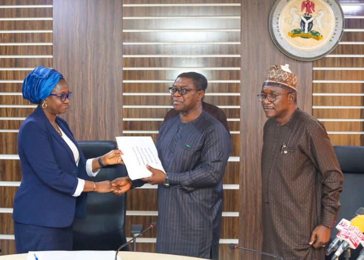
The Mineral Sector for Economic Diversification Project (MinDiver) under the Ministry of Mines and Steel Development (MMSD) yesterday handed over high-resolution airborne geophysical survey data of Southwestern Block of Nigeria to the Nigerian Geological Survey Agency (NGSA) in Abuja.
LEADERSHIP reports that the World Bank-funded MinDiver Project is an agency fashioned to support the implementation of the Roadmap for the growth and development of the Mining industry in Nigeria.
Speaking at the event, the MinDiver project coordinator, Engr Sallim Salaam, said it was another landmark achievement in geodata acquisition towards attracting meaningful investment in the Nigerian mining sector.
He said: “A high resolution airborne survey conducted over the proof of concept areas in the southern western block of Nigeria has been completed, processed and interpreted, while the same is being carried out in the remaining part of the court.
“Therefore, what we are doing today is to release the first batch of the processed and interpreted data to the ministry for onward release to the public to assist in de-risking the the sector.”
He added that the ministry had already approved the data dissemination policy that will guide the release of the data to the public.
On her part, the permanent secretary, MMSD, Dr. Mary Ogbe, explained that the airborne survey utilizes modern technology on board specialised aircraft to survey to vast areas within a relatedly shorter time and at a lower cost than using a ground survey.
She said, “Apart from cost effectiveness and speed, airborne surveys have the advantage of utilising more than one method of measuring physical quantities of the subsurface , which after processing with the aid of specialised software, return useful information on position, geometry and depth of structures and domains hosting mineral ore bodies.”
She added that the present exercise is a follow-up to the airborne survey of the entire country carried out between 2006 and 2011, but that the current survey has better resolution, is more result-oriented and richer in information due to improvements in technology, which will serve as an incentive to the investor.
According to the permanent secretary, the airborne survey is one of the many reform activities planned and executed by the ministry as government’s incentive to de-risk investment in the sector.
Dr Ogbe encouraged investors, local and foreign, to take advantage of the numerous efforts of the ministry, including the high-resolution airborne geophysical survey data to carry out further exploration of minerals titles and new fields.
Highlight of the event was the handover of the survey data document from MinDiver to the Ministry and to the Director General, Nigeria Geological Survey Agency (NGSA), Dr Abdulrazaq A. Garba.
Dr Garba said the airborne survey data is another layer of upon other layers of data generated for the use of the investors.
He added that with the data dissemination policy approved by the ministry, the data will be accessible to investors and eliminate quackery. He pledged to publish the data online for every interested stakeholder to access it.


